 “Wayfarer, there is no path, you make the path as you go.”
|
|


| English | Español | Deutsch | Français | Nederlands |
THE COUNTRY
- Why Ecuador?
- Slide Show
THE BOOK
- Foreword
- Preface
- Acknowledgments
- Table of Contents
- Trek Summaries
- Index
- About the Authors
- About the Publisher
A SAMPLE TREK
- Overview
- Route Description
- Topographic Map
- Elevation Profile
HOW TO BUY
THE BOOK
UPDATES
FEEDBACK
LINKS
CONTACT US
- The Authors
- The Publisher
© 2002-07 Kunstaetter
Alternate Route Description
|
IMPORTANT
This part of the trek was not included in the printed book due to space limitations.
If you have the book, then we hope you will enjoy this route as you would any
of the other 29 treks. Note, however, that this is not a complete route description
without the printed material in Trek 15. If you do not have the book, then you should
not undertake this trek based only on the following description. This website
does not have enough general information about safety, navigation, how to use
trek descriptions, and many other important topics discussed in the printed book.
Remember that this is a very difficult trek and see A Note About Safety.
|
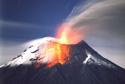
The following is a supplement to the route described in Trek 15 of the book. It includes the option of visiting Cerro Hermoso and exiting through El Triunfo, north of Baños. There are 21 kilometers (13 miles) of very difficult trekking between Yossicocha and El Triunfo, 3 to 5 additional days without climbing the mountain. This route is exceptionally scenic. When the fog lifts and reveals the silhouette of the rocky peaks of Cerro Hermoso, it is pure magic.
Route: Follow the east (left) shore of Yossicocha past its small outflow. The ground begins to drop suddenly, and a very poor trail zigzags south down the steep slope, thick with brush. In 45 minutes it reaches a broad flat saddle, 150 meters (500 feet) below the pond. Continue south across the flats, then for 15 minutes climb a low ridge to reach another level bog with a muddy lake in the middle. Follow the east (left) edge of the bog. The remains of several rudimentary shelters and good camping spots, tucked in among the low hills, are found by skirting the bog clockwise to its south side, a 20 minute detour.
To continue toward Cerro Hermoso, follow the east edge of the bog, then head southeast, dropping slightly to cross a boggy drainage reached in 20 minutes. On the far (southeast) side of the drainage is some bare rock, surrounded by vegetation. Climb southeast on the rock or along its side. Continuing in this direction and then east, in 15 minutes you will reach a large landslide. Cross it and continue east for another 15 minutes, to a small rocky stream, surrounded by dense vegetation; a somewhat difficult crossing because of slippery rocks. This stream is one of the many sources of the Río Topo. Cross the stream, then climb steeply southeast through flechas; they are thick at first, but gradually thin out as you get higher. After 2 hours of steady climbing, the terrain begins to level off and you can see a pond below to your right. A further 20 minutes brings you to the ridge crest, turn here to follow it east. It is at times razor-sharp and offers spectacular views of the surrounding expanses of convoluted topography. After 1 hour travelling east along the ridge line, you will begin to descend southeast and will reach, in 30 minutes, a small pond with sites suitable for camping. Continue descending southeast for another 30 minutes, to reach a second pond, which also offers camping possibilities.
From the second pond, you begin a steeper descent southeast into a broad boggy valley, reached in 20 minutes. Cross the valley southeast in another 20 minutes, and in 30 minutes climb a low north-south ridge. (This is a perpendicular spur of the east-west ridge along which you were travelling before the two ponds mentioned above.) Follow this broad and undulating ridge south, across several small bogs. In 30 minutes, you will reach a wide boggy saddle with areas suitable for camping along the edges, and a spring. There are a few polylepis trees on the surrounding slopes, a pleasant sight after days in the bare páramo. Take water here as it is scarce on the ridge ahead.
Climb steadily south, along the west flank of the ridge. On the way up, you will have views of two beautiful unnamed kidney-shaped lakes to the west, separated by a rocky hill. In 1 hour, you will reach the ridge top with magnificent views east to Cerro Hermoso-huge waterfalls cascading down its black-rock cliffs. Follow the ridge line south for 15 minutes, to a point where the ridge divides into two branches. There are more wonderful views of Cerro Hermoso here, and of Laguna El Cable at its base.
Our route continues along the left branch of the ridge, dropping southeast. The descent is steep, with vertical drops to your left-a place for slow and careful going-but the views of Cerro Hermoso make it all worthwhile. In 45 minutes you reach a dip in the ridge line, from where you continue to descend steeply east for 15 minutes, to a prominent east-west saddle. This is an important (but unmarked) crossroads. One route comes up from the southwest, crosses the saddle, and descends to the northeast into the flecha-filled valley of the upper Río Topo. The route you came along drops from the northwest, then climbs to the east. Here you can choose to get closer to Cerro Hermoso and perhaps climb it-a worthwhile detour in good weather-or you can continue out toward El Triunfo.
To approach Cerro Hermoso, climb east very steeply from the saddle. You will have great views of the upper Río Verde below, on your right. In 30 minutes you will reach a small flat area. Continuing further up and east for another 5 minutes, you reach a larger flat area, better for camping, with a small clear spring. Our route however, continues climbing gently to the north from the first flat area. It gradually turns east and in 10 minutes takes to a ridge line. Follow this ridge line east, steadily uphill, with outstanding views north to the immense valley of the upper Río Topo. In 30 minutes, you will reach a few small flat boggy spots suitable for camping, with very small springs for water.
Here you leave the ridge line and descend gently east for 10 minutes, along the north flank of the ridge, before climbing again, still headed east along the north flank of the ridge. In a further 10 minutes you pass below an enormous outcrop of jet-black rock on your right, impressive evidence of tectonic uplifting in the Llanganates. Climb more steeply for 20 minutes, across a few small gullies, to reach a broad saddle northeast of the point marked 4215 meters (13,829 feet) on the IGM map. There are grand views from the saddle, up to Cerro Hermoso, towering 500 meters (1650 feet) above, and down to Laguna El Cable, nestled amid rock cliffs 300 meters (1000 feet) below. This lake is also known as Laguna Brunner, so named for a Swiss treasure hunter who spent many years in this area; the remains of his shelters are still found by the lake on its southwest shore. (The authors did not descend to the lake and cannot confirm whether the shelters can be reached from this saddle.) In good weather you can continue climbing from the saddle toward the summit; see Ecuador: A Climbing Guide by Yossi Brain.
To continue toward El Triunfo from the east-west crossroads saddle mentioned earlier, descend south along any of a number of small trails. These converge at a little grove of polylepis trees, amid high flechas and boggy ground, reached in 20 minutes. Here a larger trail runs east-west; it was flagged with yellow tape in November 2001, but it is not well defined throughout its length. Although we refer to fragments of this trail in the following description, you should be aware that navigation is still very challenging along this entire route.
To the east the trail crosses the boggy valley and appears to continue up toward Laguna El Cable. (The authors did not take this route.) To the west, it climbs out of the valley and turns southwest, where it meets other small trails coming down from the saddle. In order to continue, it is important to find the larger trail. Once on the trail, follow it southwest, up to the crest of a low ridge, it takes about 15 minutes. The views back to Cerro Hermoso and the waterfall formed by the outflow of Laguna El Cable, as well as the summits of Tungurahua and El Altar to the south, are very nice.
There is a little flat bog at the top of the ridge, skirt it on the right and continue southwest undulating over low ridges and valleys; make sure to maintain this southwest course and do not drop too far into the valleys. In 30 minutes, you will reach a larger bog, once again skirt it on the right, at the base of some polylepis trees. From here the trail climbs southwest through thicker vegetation, there are sigses (sword grass) and other tall grasses, which make the going more difficult. In 30 minutes you will reach a flat area on the ridge top. Continue on the trail to cross the ridge and then descend southwest, dropping steadily along a broad valley. In 45 minutes you will cross a small stream on your left, from where the descent southwest continues into the valley of the upper Río Verde Grande. You cross the upper reaches of this important river 1 hour after the stream, at 3600 meters (11,800 feet) above sea level. At the crossing is a pretty camping spot, sadly strewn with trash. To the west you can see a nice waterfall-another tributary of the Río Verde Grande.
After crossing the river, head southwest along the left edge of the boggy plain, then through flechas. In 10 minutes, you will reach the base of the waterfall mentioned above. Cross its two branches and climb steeply west through sword grass and some trees. In 45 minutes, the ground levels off and the trail veers southwest once again, through open grassy areas, below patches of forest. To the east are views of Cerro Hermoso; with a little imagination, it looks like a sleeping woman's silhouette from this angle. In 40 minutes, you will reach a small patch of very pretty scrub forest, and after going through it, emerge at a boggy plain, above an unnamed pond. The views of Cerro Hermoso reflected in the pond are magnificent. Because of the wet ground and fragile vegetation, however, this area is not suitable for camping. If you leave the trail to take pictures, stay on paths already made by others, and take the opportunity to admire the delicate páramo flora.
Continue skirting the bog on its right side. Then follow trail fragments to climb west, at times steeply, through dense but pretty scrub. At a second bog, stay again to the right. In 30 minutes, you will reach a pass at 3900 meters (12,800 feet). There are nice views west to the valley of the Río Muyo, back east to the valley of the Río Verde Grande, and a parting glimpse of the Cerro Hermoso massif beyond. Descend southwest from the pass for 15 minutes to a large flat area, where the trail turns west to climb the side of a low hill with camping possibilities and a small spring.
From the spring, continue west, gently climbing several low hills and successively dropping to boggy plains, where the trail is easily lost. Be sure to maintain your course west and south; do not drop north into the drainage of a tributary of the Río Muyo. In 45 minutes you will reach a shallow pond amid more bog where there is another trashed camping area. (This pond, known by some locals as Laguna Negra, is not shown in the IGM maps.) Climbing west from the pond for 10 minutes, you reach another camping area on drier ground. From this site, climb southwest to the summit of the hill labeled 3746 meters (12,291 feet) on the IGM map, reached in 10 minutes. Here you at last bid farewell to the páramo, and begin to descend west through thick scrub, which gradually becomes taller forest. Despite the at times steep grade, the trail here is good. It drops along the ridge line clad in lovely cloud forest; the tall trees are thick with moss and epiphytes, the espadaña grass stands taller than you on the sides of the trail, and flocks of birds accompany you along your way.
One hour down from point 3764, you reach a very small flat spot, where one tent can be pitched in an emergency, but there is no water. From here the trail descends more steeply, over increasingly rocky terrain, making the going more difficult. The forest also deteriorates to secondary growth, with vines and nettles along the trail. In another hour, you will emerge at a small stream; cross it to reach a spot suitable for camping. From here the trail follows the small watercourse downstream and crosses it again, just before it empties into the Río Muyo, 10 minutes ahead.
You have at last reached the valley floor and might think that the most difficult parts of the trek are behind you, but this is not the case. The trail follows the east shore of the Río Muyo down river to the southwest. It crosses several less-then-stable landslides which require great caution; along them, the path may be lost. At times the trail descends to the rocky shore and, when the water level is low, the route continues in the river itself. From the confluence of the stream mentioned above with the Río Muyo, to Quebrada de los Ranchos, takes 4 hours of painstaking travel. Here at last the trail improves a little, there are fewer landslides and less walking in the river. You will reach the next large tributary, Quebrada Tres Cruces, in 2 hours. From Quebrada Tres Cruces the trail gradually widens to a muddy unpaved road. Follow it for 2 hours to the village of El Triunfo.
There are no hotels in El Triunfo, but you can ask for permission to stay at the school house. A couple of small shops sell basic provisions.
Getting back: One daily bus passes El Triunfo around dawn. Ask in town for the exact schedule, it varies with the day of the week. From El Triunfo to Baños is 22 kilometers (14 miles), 1 hour, and costs $0.75. There are also pickup trucks which do the trip in the afternoon; same price per person. At other times, you can hire a private pickup in El Triunfo to take you to Baños for about $10 (Klever Reyes is one driver).
| Route Description | Topographic Map | Elevation Profile |